Ram Mandir Unveiled from Space: ISRO’s Bird’s-Eye View of Ongoing Construction


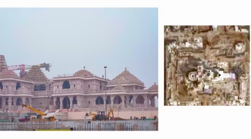
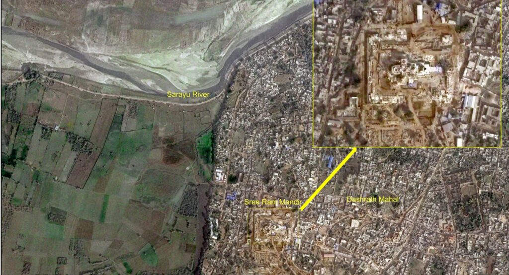
New Delhi: As excitement builds for the grand consecration ceremony of the Ram Mandir, the Indian Space Research Organisation (ISRO) has offered a unique perspective. Satellite imagery from ISRO’s Cartosat satellite, captured on December 16 and processed by the National Remote Sensing Centre (NRSC), unveils a bird’s-eye view of the partially constructed Ram temple.
The image provides a detailed insight into the ongoing construction of this sacred structure, heightening anticipation for the upcoming ‘pran pratishtha’ ceremony. This significant event will be presided over by Prime Minister Narendra Modi and officiated by a team of priests led by Lakshami Kant Dixit.
ISRO’s Cartosat series, often referred to as “India’s eye from space,” plays a crucial role in various applications, including cartography, urban and rural planning, and utility management. The satellite’s ability to capture high-resolution imagery aids in activities such as road network monitoring, water distribution, and creating detailed land use maps.
The Cartosat-3, the latest addition to the series launched in 2019, boasts advanced capabilities with very high-resolution imaging. With a spatial resolution of 0.28m for Panchromatic imagery and 1.12m for Multispectral imagery, the satellite provides a clear and detailed view of the Ram Mandir construction site.
In the lead-up to the ‘pran pratishtha’ ceremony, the idol of Ram Lalla was placed in the ‘Garbha Griha’ of the Ram temple on Friday, marking a significant step towards the completion of this revered project.
As we witness the progress of the Ram Mandir through the lens of space technology, it adds a unique and captivating dimension to the cultural and historical significance of this monumental structure.


Pingback: เว็บบาคาร่า ไม่มีขั้นต่ำ ยอดนิยม ที่เชื่อถือได้ ต้อง LSM99
Pingback: กระดาษฉาก
Pingback: Tile paint
Pingback: ล่องเรือเจ้าพระยา
Pingback: betwinner codigo promocional
Pingback: John Lobb
Pingback: safe eft cheats
Pingback: SKY Wind
Pingback: Zolabet สล็อตออนไลน์ เว็บตรงลิขสิทธิ์แท้ เว็บสล็อต 2024
Pingback: สล็อตแตกง่ายไม่มีขั้นต่ำ
Pingback: massage Bangkok
有道词典是由网易有道出品的全球首款基于搜索引擎技术的全能免费语言翻译软件。简介. 支持中文、英语、日语、韩语、法语、德语、俄语、西班牙语、葡萄牙语、藏语、西语等109种语言翻译。拍照翻译、语音翻译、对话翻译、在线翻译、离线翻译更顺畅。更多的翻译 https://www.youdaoo.com
Pingback: เครื่องซีลสูญญากาศ
Pingback: Bilad Alrafidain University
Pingback: mlm
Pingback: Freshbet
Pingback: Aviator
Pingback: ufabet789
Pingback: นินจา168
Pingback: Sweettooth
Pingback: ออกแบบโรงแรม